Founder's Retrospective
The Journey: From IvoryCane to Acquisition
The Spark & Code Name IvoryCane
It started with watching someone cross a street with a white cane. The cane told them about obstacles by hitting them — which is a pretty rough deal when the obstacle is a pothole or a set of stairs going down. Traditional white canes have a detection range of essentially zero: you learn about the hazard when the tip makes physical contact, typically at well under a metre.
The existing alternatives were not much better. Commercial electronic travel aids were expensive, often costing several thousand dollars, and most were wearable camera rigs that required separate hardware, separate charging, and a steep learning curve. I kept coming back to the same question: what if the cane itself could see ahead?
We called it IvoryCane. No grand reason — the traditional white cane is sometimes called an ivory cane colloquially, and it stuck as an internal code name. I started sketching ideas with my mentor, Sushil Kumar Pandey, during my second year.
The Hardware Pivot: Raspberry Pi to Smartphone Edge Compute
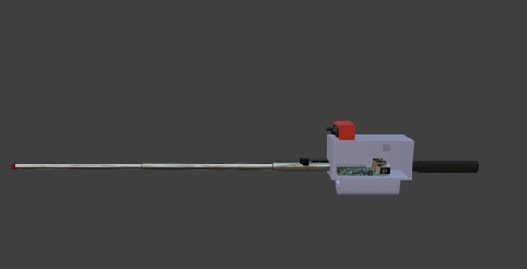
The first design was honest and ugly. We 3D-modelled an extendable cane with a Raspberry Pi mounted in a custom chassis near the grip, wired to multiple HC-SR04 ultrasonic sensors at the tip. The Pi would run object detection on a camera feed, fuse it with sonar data, and speak navigation instructions through a connected earpiece.
It worked on paper. In practice, the Pi added weight exactly where you don't want it — at the grip, where fatigue compounds over hours of use. It needed its own power supply, its own camera module, its own case. We were building a second phone and strapping it to a stick.
The pivot was obvious once we said it out loud: every user already carries a neural engine in their pocket. Modern smartphones have cameras, GPS, accelerometers, and enough compute to run real-time inference. Why duplicate all of that?
So we gutted the Pi from the design and replaced it with a custom-angled smartphone mount positioned 8–9 cm above the grip. The phone connects to the sensor microcontroller through a wired data and power bridge — USB-C handles both. We added an onboard power bank that gives about 8 hours of continuous runtime, and Bluetooth handles the low-latency audio relay to the user's earpiece.
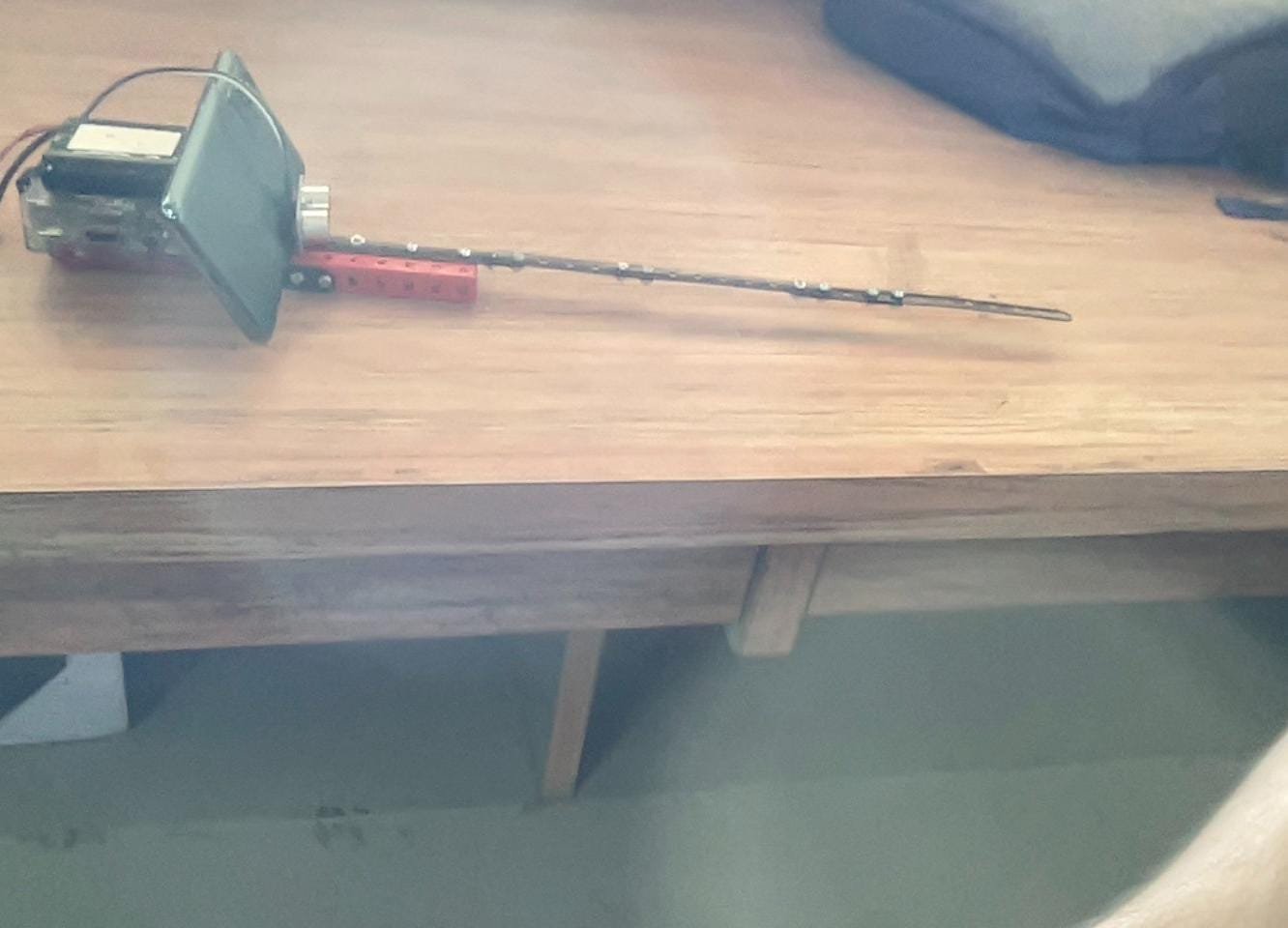
The software pipeline runs entirely on the phone. The camera stream feeds into a CNN/YOLO model for real-time object detection — it classifies walls, steps, doors, chairs, and low-hanging tree branches. Meanwhile, the ultrasonic sensors pump distance telemetry over the wired bridge. An A* pathfinding algorithm fuses the visual bounding boxes with the sonar range data and computes a safe walking path, which gets delivered as spoken turn-by-turn instructions.
One detail that took longer than expected: ground-reflection false positives on the HC-SR04 sensors. Ultrasonic pulses bounce off smooth floors and come back as phantom obstacles at close range. We solved it with a simple bottom shield — a physical baffle underneath the sensor array that blocks downward-reflected echoes. Low-tech fix for a high-frequency problem.
Field Testing with 10 Visually Impaired Users
We ran structured trials with 10 visually impaired participants across indoor and outdoor environments. The results were encouraging but not flawless, and I want to be honest about both sides.
What worked: 94% indoor object detection rate. 92% indoor classification accuracy. The system consistently warned users about obstacles at an average of 2.5 metres — compared to less than 1 metre of physical contact for a traditional white cane. 80% of participants preferred Navi-Netra over their regular cane in unfamiliar environments. 85% reported higher navigation confidence.
What was hard: Outdoor performance dropped to 87% detection and 85% classification. Unstructured environments — think uneven sidewalks, parked bicycles, overhanging branches at head height — are genuinely harder for a downward-angled camera to parse. The end-to-end detection-to-classification latency sat at around 4 seconds, which is fine indoors but feels slow when you're walking on a busy street. That 4-second number became our primary optimisation target for future work.
We also found that about 15% of participants reported mild wrist fatigue after 2 hours of continuous use. The comfort and weight score averaged 8.4 out of 10 overall, but the fatigue feedback led us to add wearable wrist straps in the final version to distribute load off the grip.
78% said they would adopt it as their primary navigation aid. Overall satisfaction came in at 8 out of 10, and audio clarity scored the same.
Rebranding to Navi-Netra & The November 2024 Acquisition
By this point, IvoryCane had outgrown its code name. We rebranded to Navi-Netra — loosely, "navigation eye" in Sanskrit. It felt right for what the device actually does: it gives the cane spatial awareness it never had.
In November 2024, an Indian technology incubator approached us after reviewing the published research. They evaluated the physical prototype, the sensor-fusion architecture, the trial data, and the complete telemetry logs from our field tests. Both the evaluation and the acquisition closed within November 2024 — a fast-track process that reflected their confidence in the validated trial results and the underlying IP.
The acquiring incubator's identity and the specific financial terms of the acquisition remain undisclosed under a strict non-disclosure agreement.
What I can say is that it was a private institutional acquisition of the project's intellectual property and research — the kind of outcome that validated years of student-led R&D work. The prototype, the sensor-fusion codebase, the detection models, and the complete trial dataset transferred as part of the deal.
This site exists as the permanent public record of what we built and what the data showed. The engineering is real, the benchmarks are real, and the 10 people who tested it told us it made a difference.
— Arnav Sharma, December 2024